Trail "The Pierredon"
The online trail on Cirkwi: http://bit.ly/CirkwiGrimaud
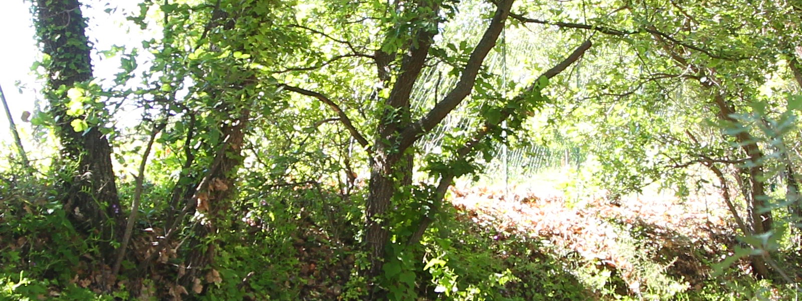
You will discover the valley of the Garde where 3 water mills previous to the seventeenth century and now disappeared, as well as a windmill, supplied the flour to the locals. A charming valley lined with olive trees is offered to you.
Description of the route:
You start your journey, in the car park located under the Moulin Saint Roch.
Take the Pont des Fées discovery trail (see description).
After passing the Fairy Bridge, at the intersection where the path goes up towards the mill, pass the great wooden barrier and continue straight down. 50m after crossing a small ford on the torrent of La Garde, you notice on the left, an old olive grove and an ancient bastide of the XVIIIth century.
Farther on, on the right, take the bridge that crosses the river and engage on the paved road.
After 500m of climb, at the intersection, go along the National Road, to the Tourist Office. Then, join the Place Neuve. From here, a visit of the village is necessary.
Then take the direction "Mairie" and "Moulin Saint Roch".
You came back to your starting point.
Trail of the Vallon du Pont des Fées Quality Trail of Var
The online trail on Cirkwi: http://bit.ly/CirkwiGrimaud
This itinerary labeled "Sentier Varois de Qualité" meets quality criteria mainly linked to the remarkable heritage crossed (natural, cultural, architectural ...) but also to criteria of security and land management. THE SITE: Close to the village, dominated by its castle, this loop will allow you to admire the natural and historical patrimony of the valley of the small river "La garde" with its bridge of the Fées, and, on the height, the windmill of St Roch. It is an opportunity to discover these places full of history.
THE PARKING : Car park of the Cemetery of the bottom under the Moulin Saint Roch. N 43.27663 °, E 6.52096 ° THE COURSE : Tip: download the associated topoguide sheet. Follow directional signage: posts (white arrows).
- 1. From the parking lot, go to the board of departure of the promenade
- 2. From the 1st sign, take the path of discovery on the left. Other panels present the main characteristics of fauna, flora, built heritage, as well as an interpretation of the landscape. Go down and join the river "La Garde". Note the vestiges of the water intake and the beal (canal) which supplied until the beginning of the XIX ° century the two water mills of the commune.
- 3. At the fairy bridge, another vestige of the old hydraulic system, continue right on the small path that runs along the river. You may observe the tortoise Cistude or that of Herman, hosts of these banks. The rich flora includes, with other protected species, the Neglected Orchid Serapas, the Viperina of Crete or the Cistus of Sage Leaf.
- 4. Turn right and follow the stony path lined with cork and cork oaks, maritime pines and fragon, which goes up towards the Saint Roch mill. Admire the panorama on the medieval castle of Grimaud, the plain and the golf of Saint Tropez. From the mill take towards the south, the small path and the stairs to the right of the big oak to reach the parking.
TO BE NEARBY: • Source • Béal • Pont des fées: a structure built at the end of the 16th century, it supplied the village with a canal. • Orientation table • Moulin Saint Roch: open from 01/07 to 31/08. Known since the 16th century, it was used to grind corn. Restored in 1990.
RECOMMENDATIONS
- Fragile site: do not leave the trail.
- Always inform you about the weather.
- During the hunting season, do not walk away from the marked paths.
- Only use the trail in the authorized time period!
- Ask about the state of opening of the forest massifs, especially in the summer. (See website of the prefecture of Var).
- Provide sufficient water and proper footwear
Trail "Grimaud / Port-Grimaud"
The online trail on Cirkwi: http://bit.ly/CirkwiGrimaud
This circuit will make you discover a part of the plain of Grimaud, which made its fortune for centuries, between cultures and wild spaces of edge of river.
The word Peyron, from the ancient Provencal peira, stone, refers here to the large flat stones that used to ford the Giscle.
Description of the route: Departure near the kennel club. Take the Ajusts path, which crosses a residential area for a few hundred meters. Take the dirt road to the right, which long vineyards. The beautiful trees that populate this part of the plain are ash trees. In the eleventh century already, the whole territory that now covers the community of communes, was called the Fraxinetum, the Freinet, of the name of this tree. At the next intersection, turn right and follow the La Giscle River. Between the clumps of trees one can distinguish the perched village of Grimaud. The canes of Provence, grow spontaneously on this wet ground of edge of brook. The man cultivates this large grass for various uses. Formerly used in construction, for the drying of commodities, it is today cultivated for the making of reeds for wind instruments. Leave on your left the bridge leading to Cogolin and continue on the road to Saint-Pierre road. Turn right and join your starting point.
Trail "La Calade"
The online trail on Cirkwi: http://bit.ly/CirkwiGrimaud
Discover the hills bordering the torrent of La Garde and the old road going up to the village, passing by the Oratory Saint Joseph.
Description of the route:
You start your journey, in the car park located under the Moulin Saint Roch.
The circuit is identical to that of Pierredon, but at the bridge, continue straight on the track, parallel to the river. After 250m, at the intersection, continue to the right, along the river. Small cabanons are in the middle of the vineyards.
After 700m, take the bridge, on the right, direction "le chemin de la calade", the provencal calado: "paved path".
After 700m of climb, you arrive at the Saint Joseph's Oratory.
The road that is open to you is the old road from Grimaud to Sainte-Maxime.
Continue straight up to the National Road.
Walk to the tourist office. The return to your starting point is made by the itinerary of the previous circuit.
Trail "La Castellane"
The online trail on Cirkwi: http://bit.ly/CirkwiGrimaud
Discover the plain and the charming districts located to the south of the village. The splendid view of the village and the hills that surround it, enhances this walk.
Description of the route:
You start your journey in front of the Tourist Office.
Cross the road, then turn right, and walk along the house opposite the Heritage Museum (Be careful, the sidewalk is narrow!). Then, turn left and go down the path to the Enclos.
After about 350m, at the first intersection, turn right. Thirty meters further, turn left on 100m, then again on the left: you are now on the way to La Castellane. This place dates from the Middle Ages. In Provençal, "castellan" means "chatelain, haughty man".
After crossing the Reparade district (from the Latin "reparata" then from the Provencal "Réparado", name of female baptism, such as the Cathedral Sainte-Réparate in Nice), turn right at the intersection, where is a family vault of two Grimaud families. This private building, resembling a chapel, dates from the 19th century.
Continue straight on towards Vicairie and after 400m, at the intersection, turn left and take chemin Mignonne towards the village. You walk along a large meadow where horses are often found and where you can enjoy a superb view of the village.
After a slightly steeper climb, you will reach the National Road.
Go left and walk along the Beausoleil building, which was the first hotel in the village in 1875.
Go up the National Road to return to your departure point, in front of the Tourist Office.
Grimaud Coastal Cycle Route
The Six-Fours / ST. Raphaël (V65 of the National Plan of the Véloroutes and Greenways) makes it possible to traverse in large part the Var coastline by the coast or the inland by following the route of the old way of railway of Provence and crossing 20 municipalities . Borrowing this route, it is to discover all the diversity of the landscapes, the richness of the flora and an exceptional coastal space. It expands over time with new developments. To this day 92 km of the 120 km are arranged on this course of which 77 km in own site. Beware, between Six-Fours / ST. Raphael, some portions of the course are not yet finalized and require borrowing portions of highways. Check the condition of the route by consulting the legend of the map of the selected route. The section of the Parcours Cyclable du Littoral in the commune of Grimaud, a section in a clean and shared site existing on a length of about 5,5 km.
POINT START / ARRIVAL
After passing the bridge of the Giscle continue until the beach of Guerrevieille in direction of Sainte-Maxime in own site and shared over a length of 5,5 km. PARKING - Different car parks along the route
RECOMMENDATIONS
Recommended headset port - Lighting and buzzer are mandatory - Roll in Indian file on roadway - Mark stop at red light and stop - The cycle path of the coastline is above all dedicated to a convivial practice. It excludes excessive speeds, each having to respect the free practice of others for the safety of all.
PRECISION
- Bike lane: own site reserved for cycles with two or three wheels, indicates to the pedestrians and the drivers of the other vehicles that they are not allowed to borrow or stop there (except vehicles of firemen, police, service vehicles and on certain sections to authorized residents and moped riders). In the absence of sidewalks or passable shoulders, non-motorized users (pedestrians, rollers, people with reduced mobility ...) must walk on the left side of the roadway.
- Greenway: a site exclusively reserved for non-motorized vehicles and pedestrians (except emergency vehicles, fire-fighters, police, service vehicles and on certain sections to authorized residents and cyclomotorists).
When the competent police authority also decides to authorize the movement of riders, the panel is completed by the sign "M4y" designating the riders.
- Shared site: route shared between different motorized users or not.
HAVE TO DO
- Village of old Grimaud
- Cité Lacustre of Port Grimaud
- Ruins of the medieval castle


 GRIMAUD